EPA’s Integrated Climate and Land-Use Scenarios (ICLUS) explores future changes in human population, housing density, and impervious surface (soon to be available for ICLUS version 2) for the United States. These projections are broadly consistent with peer-reviewed storylines of population growth and economic development that are now widely used by the climate change impacts community. You can access the ICLUS datasets and documentation from the main ICLUS web-site: https://www.epa.gov/iclus.
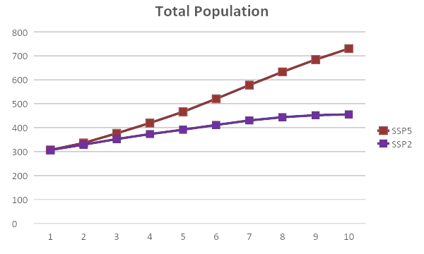
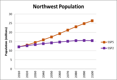
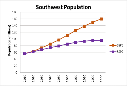
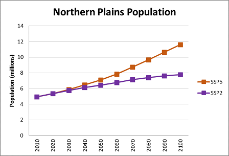
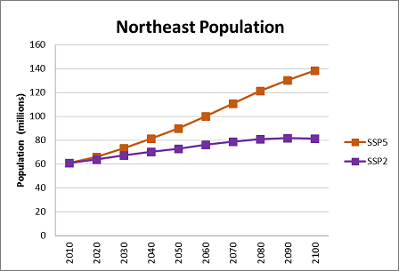
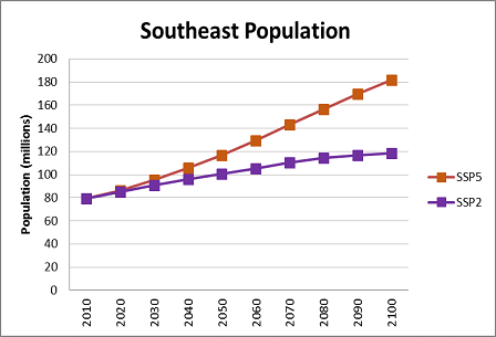
The different population and land use change scenarios stem from global population and urbanization assumptions underlying two different future trajectories from the Shared Socioeconomic Pathways (SSPs) effort: SSP2, which represents a 'business as usual' trajectory, similar to the U.S. Census population projection (out to 2060), and SSP5, which represents a trajectory with higher fertility and higher net migration into the United States. ICLUS data (version 2) outputs being made available to the regional groups of the National Climate Assessment consist of both population and land use projections. Two ICLUS projections are provided, based on the 2010 U.S. Census and using fertility, mortality and immigration rates from the Wittgenstein Centre (http://witt.null2.net/shiny/wic/) to project decadal population to 2100, consistent with the demographic assumptions of the SSP2 and SSP5 socioeconomic scenarios, respectively. These ICLUS population projections are used as inputs to a land use model, which spatially allocates five residential land uses (exurban-low, exurban-high, suburban, urban-low, urban-high) as well as commercial and industrial uses.
Projection datasets are available for each of the NCA4 regions, and are available at https://www.epa.gov/iclus/iclus-data-northwest-region.
All datasets are compatible with standard geographic information systems. Documentation, including updates to the ICLUS modeling system can be found at https://cfpub.epa.gov/ncea/iclus/recordisplay.cfm?deid=322479.
Population: CONUS
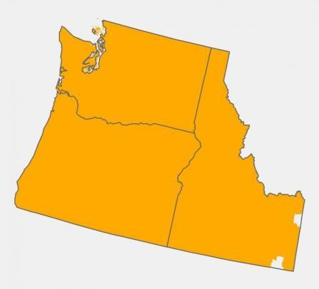
Population: Northwest
Population: Southwest
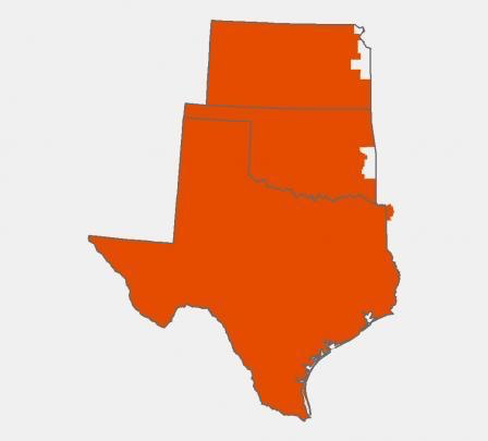
Population: Northern Plains
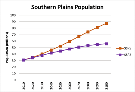
Population: Southern Plains
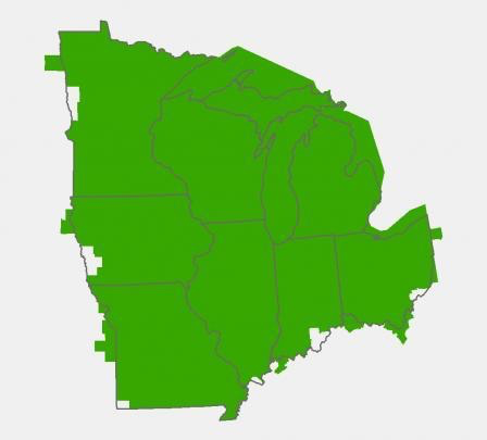
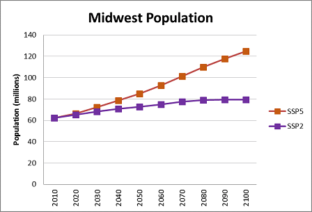
Population: Midwest
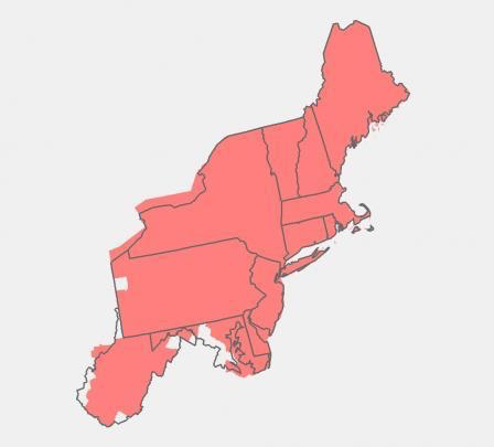
Population: Northeast
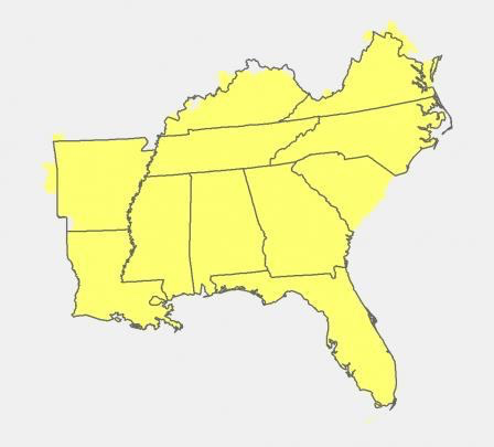
Population: Southeast
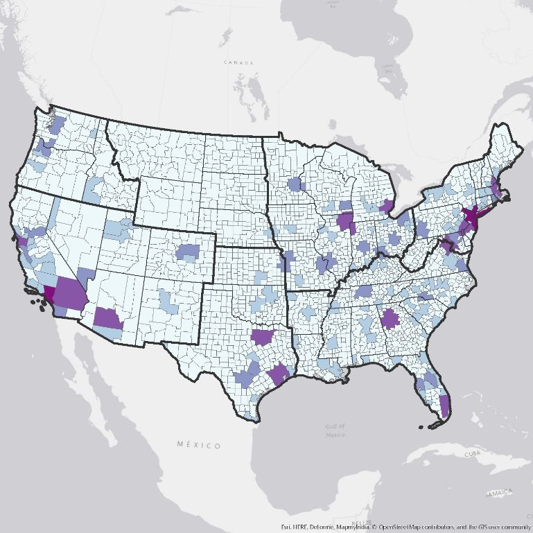
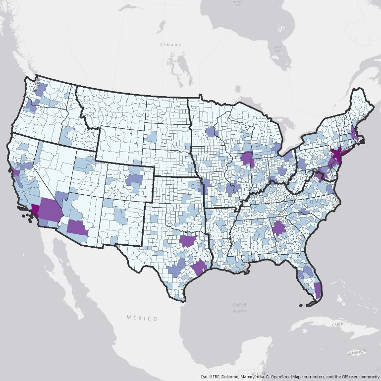
Population by County
2010
2100: SSP2
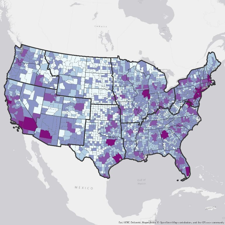
2100: SSP5
Developed Land Area: CONUS
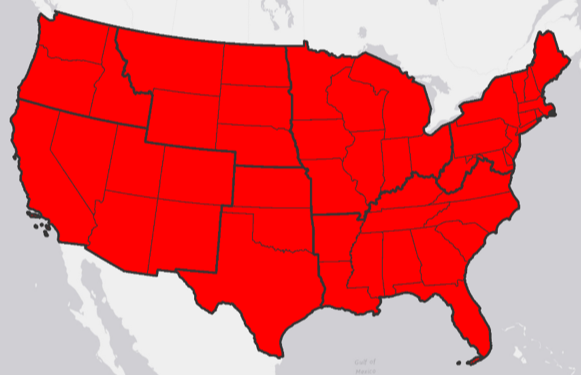

Developed Land Use by County: CONUS

2010

2100: SSP2
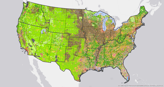
2100: SSP5
Developed Land Use: Portland, OR

2010

2100: SSP2
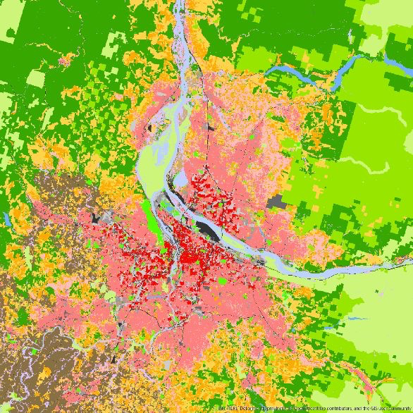
2100: SSP5
Developed Land Use: DC Baltimore

2010

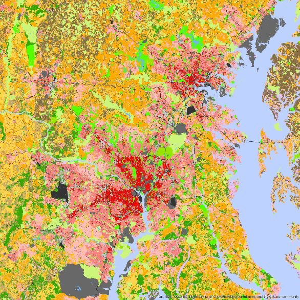
2100: SSP2
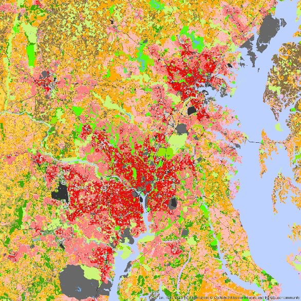
2100: SSP5
Links
- ICLUS main page: https://www.epa.gov/iclus
- Data for the NCA4 regions: https://www.epa.gov/iclus/iclus-data-northwest-region
- Documentation: https://cfpub.epa.gov/ncea/iclus/recordisplay.cfm?deid=322479
- Wittgenstein Centre: http://witt.null2.net/shiny/wic/