General Information
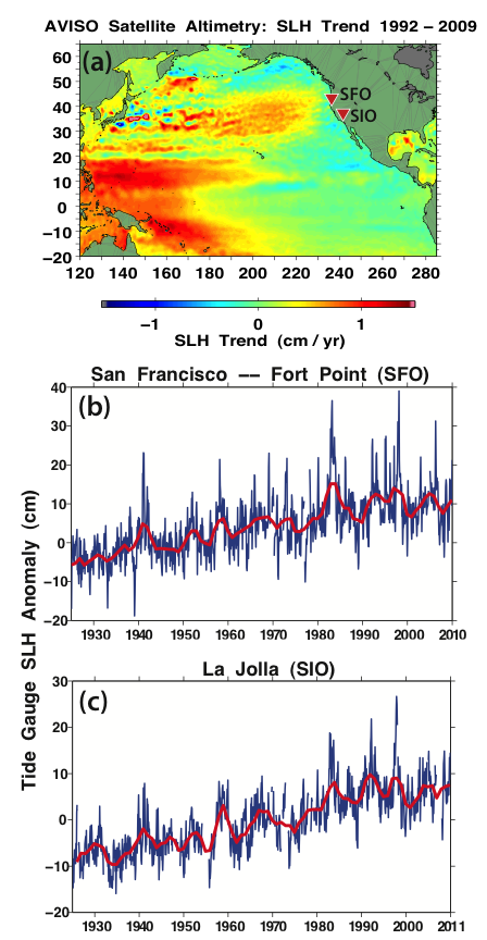
(a) Map depicting the spatial distribution of least squares trends in satellite altimetry sea level height (SLH) across the North Pacific basin over the 1992 to 2009 time period. Observed tide-gauge sea level monthly anomalies, with 3-yr running means (red lines). Graph visualization of those trends at (b) San Francisco (SFO) and (c) La Jolla (SIO) (locations in (a)). Note the near-zero trend along the US West coast in (a) that is reflected in the SFO and SIO tide gauge records since about 1980.
Data Type:
Observed
Variable Type:
Sea
Region:
Files